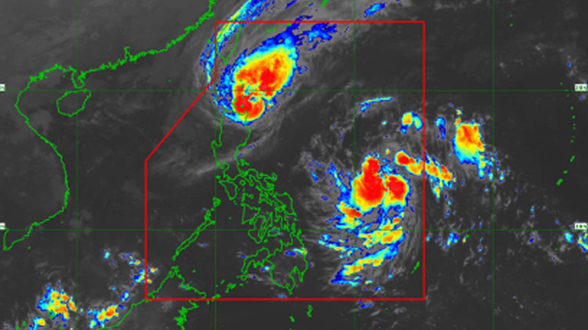
Typhoon “Ramon” (Kalmaegi) slowed down while moving towards the Babuyan Islands.
At 7 a.m. Tuesday, the Philippine Atmospheric, Geophysical and Astronomical Services Administration (PAGASA) said “Ramon” was spotted 110 kilometers east of Calayan, Cagayan.
“Ramon” is packing maximum sustained winds of up to 120 kilometers per hour (kph) near the center and gustiness of up to 150 kph. It is moving slowly in a west-northwest direction.
“Ramon” is expected to make landfall over the Babuyan Islands on Tuesday afternoon and may weaken due to its land interaction with the northwest monsoon.
Tropical Cyclone Wind Signal (TCWS) No. 3 is hoisted over the northern part of Cagayan, in the towns of Santa Praxedes, Claveria, Sanchez Mira, Pamplona, Abulug, Ballesteros, Aparri, Calayan, Camalaniugan, Buguey, Santa Teresita, Gonzaga, and Santa Ana.
TCWS No. 2 is raised over Batanes, Apayao, Kalinga, Abra, Ilocos Norte, Ilocos Sur, and the rest of Cagayan while TCWS No. 1 is in effect over the northern portion of Isabela (Sta. Maria, San Pablo, Maconacon, Cabagan, Sto. Tomas, Quezon, Delfin Albano, Tumauini, Divilacan, Quirino, Roxas, Mallig, San Manuel, Burgos, Gamu and Ilagan City), Mountain Province, Benguet, Ifugao, La Union and Pangasinan.
The typhoon will bring moderate with frequent heavy rains over Batanes, the northern portion of Cagayan including the Babuyan Islands, Apayao and the northern portion of Ilocos Norte.
Light to moderate with intermittent heavy rains over the northern portion of Isabela, Kalinga, Abra and the rest of Cagayan and Ilocos Sur.
On Wednesday, light to moderate with occasional heavy rains will pour over Batanes, northern and eastern portions of Cagayan including the Babuyan Islands, the eastern portion of Isabela, Apayao, and Kalinga. Light to moderate with intermittent heavy rains over the northern portion of Aurora and the rest of Cagayan and Isabela.
“Ramon” is expected to leave the Philippine Area of Responsibility on Thursday morning.
Meanwhile, a low-pressure area located 810 kilometers east of Guiuan, Eastern Samar is expected to develop into a tropical depression within the next 24 hours.
It will be given the local name Sarah. (PNA)


