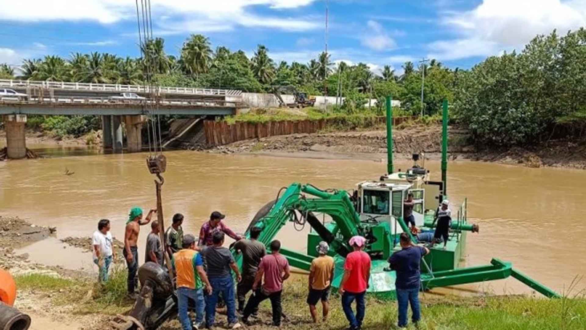
The Davao del Norte government has purchased a Watermaster, a mobile amphibious multipurpose dredger intended primarily for the Libuganon River in Tagum City.
The province is under a state of calamity after the PHP50.3-million damage in agriculture and infrastructure was recorded due to widespread flooding in six areas this week.
The Davao del Norte Provincial Disaster Risk Reduction and Management Office said the affected local government units are the towns of Asuncion, Kapalong, Santo Tomas, New Corella, Carmen and Tagum City.
In a Facebook post on Friday, Governor Edwin Jubahib said dredging will help prevent future disasters.
“Flooding is a persistent problem in our province and we must take proactive measures to mitigate its effects. The Watermaster is a crucial step towards achieving this goal,” Jubahib said.
The Watermaster will effectively remove silt, sediment and other impurities from the river.
“By dredging the rivers, there would be an improved flow of water and prevent flooding,” Jubahib said.
The purchase will support the province’s “Oplan Kanal (Channel)” program which entails regularly desiltation in major rivers.
In Carmen town, 40 familes from Barangay Mabaus recently participated in flood drill simulation exercise, part of the Scaling Up Community Resilience (SCORE) Building to Disasters in the Davao Region to enhance the capabilities of communities to reduce risks of natural hazards.
Meanwhile, Senate President Juan Miguel Zubiri urged government agencies to identify areas that are at high risk for national disasters and to create a national hazard map to minimize the loss of lives and properties.
Zubiri has filed Senate Bill No. 1810 or an Act Providing for the Issuance of a List of Low-lying areas of the Philippine Territory Vulnerable to Rising Sea Levels as a Result of Climate Change.
To be led by the Department of Environment and Natural Resources, Department of Science and Technology and Climate Change Commission, the creation of a national hazard map will be a solid first step in studying areas of high risk and is very effective in Japan, where hazard maps show the possibility of occurrence, magnitude and location of potential earthquakes, according to Zubiri.
“For a country that has lost millions of people to earthquakes, floods and all sorts of natural disasters, effective disaster risk management measures are long overdue. This is a particularly urgent concern given that we are an archipelagic country in an age where the globe is facing rapid ecological decline,” he said in his explanatory note. (PNA)


